Showing 67 items matching water resources
-
 Wodonga & District Historical Society Inc
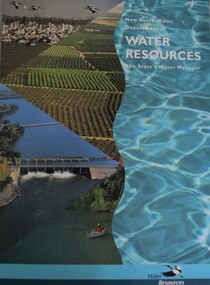
Booklet - New South Wales Department of Water Resources: The State's Water Manager, Department of Water Resources New South Wales, 1994
... New South Wales Department of Water Resources: The State's...New South Wales Department of Water Resources: The State's...new south wales. department of water resources...Department of Water Resources New South Wales... South Wales Department of Water Resources: The State's Water ...This publication includes sheets related to water facts and information about water issues in New South Wales, Australianon-fictionThis publication includes sheets related to water facts and information about water issues in New South Wales, Australiawater-supply, new south wales. department of water resources, water resources development -
 Wodonga & District Historical Society Inc
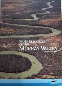
Book - Water Resources of the Murray Valley, Department of Water Resources New South Wales, 1992
... Water Resources of the Murray Valley...Water Resources of the Murray Valley...water resources development...Department of Water Resources New South Wales... Resources of the Murray Valley Book Water Resources of the Murray ...A study of the Murray River water management and resources, including illustrations and maps.non-fictionA study of the Murray River water management and resources, including illustrations and maps.water resources development, water quality management -- murray river region, murray river -
 Wodonga & District Historical Society Inc
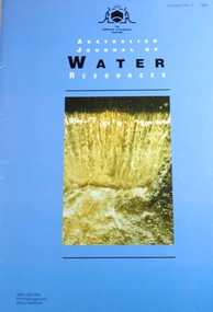
Journal - Australian Journal of Water Resources, The Institution of Engineers Australia, 1998
... Australian Journal of Water Resources ...Australian Journal of Water Resources ...water resources australia... Australian Journal of Water Resources Journal Australian Journal ...Australian Journal of Water Resources’ aims to support innovative water resources planning and management and the advancement of related professional practice in Australia and its surrounding region by publishing refereed technical papers and a range of articles of interest to the profession.non-fictionAustralian Journal of Water Resources’ aims to support innovative water resources planning and management and the advancement of related professional practice in Australia and its surrounding region by publishing refereed technical papers and a range of articles of interest to the profession.water management, water resources australia -
 Whitehorse Historical Society Inc.
Pamphlet, Victoria's Water Resources
... Victoria's Water Resources...victoria. ministry of water resources and water supply...Pamphlet by Ministry of Water Resources and Water Supply... Mitcham melbourne Pamphlet Pamphlet Victoria's Water Resources ...Pamphlet by Ministry of Water Resources and Water Supply for Use Water Wisely Campaign.Pamphlet by Ministry of Water Resources and Water Supply for Use Water Wisely Campaign.Pamphlet by Ministry of Water Resources and Water Supply for Use Water Wisely Campaign.water supply, victoria. ministry of water resources and water supply, melbourne and metropolitan board of works, state rivers and water supply commission -
University of Melbourne, Burnley Campus Archives
Document, Land & Water Resources Research & Development Corporation, 1999-2000
... Land & Water Resources Research & Development Corporation...land and water resources development research...Papers relating to the Land & Water Resources Research... Boulevard Richmond melbourne Document Land & Water Resources ...land and water resources development research, ruth beilin -
 Wodonga & District Historical Society Inc
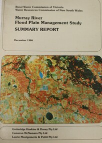
Book - Murray River Flood Management Study December 1986 - Summary Report, Rural Water Commission of Victoria
... Water Resources...Water Resources Commission of New South Wales...Floodplain management -- Murray River Water Resources ...This publication is the Summary Report of a study of the management of water resources and management of the Murray River. It was jointly commission by the Rural Water Commission of Victoria and the Water Resources Commission of New South Wales. The Rural Water Commission of Victoria was established in 1984. The Commission was renamed in 1992, becoming the Rural Water Corporation. The Water Resources Commission of NSW was constituted in 1976. The Water Administration Act, 1986 abolished the Water Resources Commission replacing it with the Department of Water Resources on 1 January 1987.non-fictionThis publication is the Summary Report of a study of the management of water resources and management of the Murray River. It was jointly commission by the Rural Water Commission of Victoria and the Water Resources Commission of New South Wales. The Rural Water Commission of Victoria was established in 1984. The Commission was renamed in 1992, becoming the Rural Water Corporation. The Water Resources Commission of NSW was constituted in 1976. The Water Administration Act, 1986 abolished the Water Resources Commission replacing it with the Department of Water Resources on 1 January 1987. floodplain management -- murray river, water resources -
Whitehorse Historical Society Inc.
Pamphlet, Make Every Drop Count
... victoria. ministry of water resources and water supply...Pamphlet by Ministry of Water Resources and Water Supply... by Ministry of Water Resources and Water Supply for Use Water Wisely ...Pamphlet by Ministry of Water Resources and Water Supply for Use Water Wisely Campaign.Pamphlet by Ministry of Water Resources and Water Supply for Use Water Wisely Campaign.Pamphlet by Ministry of Water Resources and Water Supply for Use Water Wisely Campaign.water supply, victoria. ministry of water resources and water supply -
Tatura Irrigation & Wartime Camps Museum
Report, Report on Water Resources of Victoria, 1961
... Report on Water Resources of Victoria... Tatura the-murray Report Report on Water Resources of Victoria ...Report used during the 1960's when major improvements were made to the irrigation system in Victoria. Includes investigation, conservation and utilization, water distribution and losses in channel systems. Methods of reducing seepage lossesLight brown, lightweight cardboard cover. Green Spine.relative to salinity, drainage etc, documents, irrigation -
 Beechworth Honey Archive
Article, Honey Residue Testing Annual Datasets 2015-16 (Dept Of Agriculture and Water Resources), 2016
... Agriculture and Water Resources)... (Dept Of Agriculture and Water Resources) A4 article, no cover ...A4 article, no cover, 2015-16 4 pages -
 Beechworth Honey Archive
Article, Honey Residue Testing Annual Datasets 2014-15 (Dept Of Agriculture and Water Resources), 2015
... Agriculture and Water Resources)... (Dept Of Agriculture and Water Resources) A4 Article, no cover 4 ...A4 Article, no cover 4 pages -
 Eltham District Historical Society Inc
Book, Department of Zoology, The University of Melbourne, The Diamond Creek Catchment Study: A report on the Land and Water Resources of the Diamond Creek Catchment, 1994
... Water Resources of the Diamond Creek Catchment... on the Land and Water Resources of the Diamond Creek Catchment Spiral ...Shire of Nillumbik -
 Otway Districts Historical Society
Book, A trust in water, 1990
... a trust in water; r.j. mccormick; colac; water resources...The harnessing of the bountiful water resources... of the bountiful water resources of the Otways as a critical element ...The harnessing of the bountiful water resources of the Otways as a critical element in the urban and agricultural development of the Colac region.A trust in water. A history of 100 years of water supply to the Colac district. R.J. McCormick. 1st ed. np; R.J. McCormick; 1990. xxii, 324 p.; illus, map. Hard cover. ISBN 0 7241968 2 X a trust in water; r.j. mccormick; colac; water resources; sewerage; west gellibrand dam; otways; -
 Wodonga & District Historical Society Inc
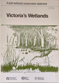
Book - Victoria's Wetlands, Dept. of Conservation, Forests & Lands, 1986
... & Lands, Department of Water Resources, Victoria, Ministry... of Conservation, Forests & Lands, Department of Water Resources, Victoria ...This publication was the result of an inquiry into the state of wetland environments in Victoria. It produced a draft strategy for conservation of threatened areas in the future.An 22 page book containing maps and illustrationsThis publication was the result of an inquiry into the state of wetland environments in Victoria. It produced a draft strategy for conservation of threatened areas in the future.wetland protection, wetlands victoria, water conservation -
Tatura Irrigation & Wartime Camps Museum
Book, Northern Irrigation District Advisory Boards, 1946
... water resources..., allocation of water, irrigation advice etc. water resources books ...Programme of converence, Bendigo 1st and 2nd August, 1945. information on water conservation, allocation of water, irrigation advice etc.Small booklet of programme of irrigation converence, Bendigo 1st and 2nd August, 1945water resources, books, history, local -
 Otway Districts Historical Society
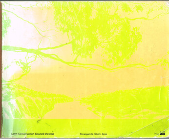
Book, Land Conservation Council, Report on the Corangamite Study Area, May 1976
... ; physiography; climate; water resources; soils; vegetation; fauna;...; geology; physiography; climate; water resources; soils; vegetation ...The Report describes and assesses the natural resources of public land in the Corangamite study area, and provides a factual basis on which members of the community may base their submissions to the Council.Report on the Corangamite study area. Land Conservation Council. Melbourne; Land Conservation Council; May 1976. x, 310 p.; illus, maps (separate). Soft cover.land conservation council; corangamite; geology; physiography; climate; water resources; soils; vegetation; fauna; -
 Wodonga & District Historical Society Inc
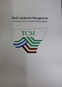
Booklet - Total Catchment Management: Community and Government Working Together, Department of Conservation and Land Management, C. 1993
... water resources australia... Working Together catchment management water resources australia ...Information sheets outlining the need for Total Catchment Management and what this approach means for management into the future,non-fictionInformation sheets outlining the need for Total Catchment Management and what this approach means for management into the future,catchment management, water resources australia -
 Wodonga & District Historical Society Inc
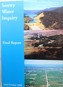
Book - Snowy Water Inquiry Final Report 23rd October 1998, Robert Webster et al, 1998
... water resources developmen... allocations water resources developmen The Snowy Water Inquiry ...The Snowy Water Inquiry was commissioned in 1998 with a brief to recommend environmental water release options to the Commonwealth, Victorian, and NSW Governments so that corporatisation of the Snowy Mountains Scheme could proceed. This book contains the findings of the Inquiry into water allocation and uses of the Snowy River.A book of 160 pp - Snowy River Inquiry Final report 23rd October 1998. Submitted to the Governments of New South Wales and Victoria / Commissioner: The Hon. Robert Webster. On the front cover are three aerial photographs of the Snowy River and Snowy Hydro Scheme. The book contains maps and photographs.non-fictionThe Snowy Water Inquiry was commissioned in 1998 with a brief to recommend environmental water release options to the Commonwealth, Victorian, and NSW Governments so that corporatisation of the Snowy Mountains Scheme could proceed. This book contains the findings of the Inquiry into water allocation and uses of the Snowy River.snowy river hydro, snowy river government inquiry, water allocations, water resources developmen -
 Wodonga & District Historical Society Inc
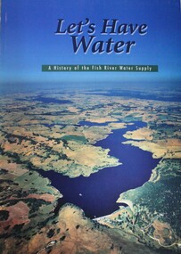
Book - Let's Have Water - A history of the Fish River Water Supply, Robin McLachlan, Denis Barrett, Jack Domis, Nick Welling, 1997
... water resources development nsw australia... dam water resources development nsw australia A history ...A history of the development of the management of the Fish River Water Supply Scheme in Central NSW. The scheme extends across the local government areas of the Shire of Oberon, the City of Lithgow and the City of the Blue Mountains.non-fictionA history of the development of the management of the Fish River Water Supply Scheme in Central NSW. The scheme extends across the local government areas of the Shire of Oberon, the City of Lithgow and the City of the Blue Mountains.water nsw, fish river region nsw, oberon dam, water resources development nsw australia -
 Tarnagulla History Archive
Telegram: Bagge to Inspector General of Public Works, 14th October, 1863
... office telegrams bagge water resources inspector general ...Murray Comrie Collection. A telegram sent from a C.H.O. Bagge in Tarnagulla to the Inspector General of Public Works in Melbourne on October 14th, 1863. Concerns checking of water levels in Inglewood and Tarnagulla Reservoirs, cost to build water races and planned travels to Dunolly and St. Arnaud.tarnagulla, post office, telegrams, bagge, water, resources, inspector general of public works, infrastructure, correspondence, communication, government -
 Wodonga & District Historical Society Inc
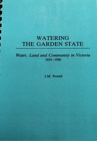
Book - Watering the Garden State - Water, Land and Community in Victoria 1834-1988, J.M. Powell
... Water resources development...Water resources development Water-supply -- Victoria ...This publication traces the importance of water resources to Australian society, with reference to the state of Victoria. It relates the history from 1834 including topics such as community adaptation to settlement planning for squatters, miners, immigrants and colonials; conservation and water management; expansion and consolidation of statutory bodies following the creation of the Department of Water Resources in 1984; and finally the effects of regionalism, environmentalism, urban conflict and institutional reform. It includes an appendix containing a brief chronology of significant events regarding water from 1853 to 1987.Spiral bound booklet with laminated covernon-fiction This publication traces the importance of water resources to Australian society, with reference to the state of Victoria. It relates the history from 1834 including topics such as community adaptation to settlement planning for squatters, miners, immigrants and colonials; conservation and water management; expansion and consolidation of statutory bodies following the creation of the Department of Water Resources in 1984; and finally the effects of regionalism, environmentalism, urban conflict and institutional reform. It includes an appendix containing a brief chronology of significant events regarding water from 1853 to 1987.water resources development, water-supply -- victoria -- history., water victoria -
University of Melbourne, Burnley Campus Archives
Book - Report, E.B. Littlejohn, Victoria 1944 State Regional Boundaries Committee Report on Regional Boundaries, 1944
... and Development, geographical, weather, power, water resources, crops..., weather, power, water resources, crops, livestock, etc. See paper ...See paper catalogue for complete contents. Item formerly property of E.B. LittlejohnReport includes maps of Regions for Planning and Development, geographical, weather, power, water resources, crops, livestock, etc.e.b. littlejohn, planning, development, regions -
Federation University Historical Collection
Book, Department of Infrastructure, Regional Matters: An Atlas of Regional Victoria, C2003
... services, education, and water resources..., and water resources Victoria regional victoria population migration ...Green soft covered book including chapers on population, jobs and industry, housing, road and rail transport, health services, education, and water resourcesvictoria, regional victoria, population, migration flow, jobs, industry, export, food production, housing, rail, roads, health, education, qualifications, water, irrigation -
Tatura Irrigation & Wartime Camps Museum
Book, Natural Resources and Environment Committee of Cabinet, Salt Action, 1987
... strategy for managing the / salinity of land and water resources... for managing the / salinity of land and water resources / salt force ...Soft cover. Off white background. Dead grey trees, dark green writing, 56 pages.On cover "Government of Victoria / Salt action / Victoria's strategy for managing the / salinity of land and water resources / salt force / draft / February 1987" -
Whitehorse Historical Society Inc.
Pamphlet, Melbourne's water; a community problem, 1968
... water resources and the dangers of the Lower Yarra Dam proposals.... water resources and the dangers of the Lower Yarra Dam proposals ...Collection of papers relating to Melbourne's future water needs by Leigh Blackburn with map extractsCollection of papers relating to Melbourne's future water needs by Leigh Blackburn with map extracts defining the area the author considers the most suitable for the development of future water resources and the dangers of the Lower Yarra Dam proposals.Collection of papers relating to Melbourne's future water needs by Leigh Blackburn with map extracts water supply, melbourne and metropolitan board of works, state rivers and water supply commission, lower yarra dam -
Tatura Irrigation & Wartime Camps Museum
Map, State Rivers and Water Supply Commission, Goulburn Irrigation System, C 1940
... . Also indicated by shading are: natural water resources... are: natural water resources, proposed extensions, existing stock ...A map showing the extent of Goulburn irrigation C. 1940. Also indicated by shading are: natural water resources, proposed extensions, existing stock and domestic supply areas, reservoirs, main channels, principal distribution channels, and railways.Irrigation Rivers Victoria.irrigation, victoria state rivers and water supply commission, map -
 Wodonga & District Historical Society Inc
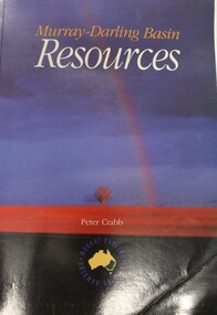
Book - Murray Darling Basin Resources, Peter Crabb, 1997
... Canberra Murray-Darling Basin Water management Natural resources ...Peter Crabb has carried out a wide range of research related to water resource management in Australia. This report is the result of research completed for the Murray-Darling Commission. The annotated statistics it provides are the first attempt to provide a comprehensive audit of the natural, economic and human resources of the region. It also makes extensive use of photographs and other illustrations. It is a major contribution to the cause of achieving sustainable resource use in the Murray-Darling Basin.non-fictionPeter Crabb has carried out a wide range of research related to water resource management in Australia. This report is the result of research completed for the Murray-Darling Commission. The annotated statistics it provides are the first attempt to provide a comprehensive audit of the natural, economic and human resources of the region. It also makes extensive use of photographs and other illustrations. It is a major contribution to the cause of achieving sustainable resource use in the Murray-Darling Basin.murray-darling basin, water management, natural resources -
Glen Eira Historical Society
Article - Glen Eira Parks and Gardens
... Resources Water Supply Ovals Playing fields Tennis Courts ...This file contains four items. An article in the Glen Eira News reporting on a new park with indigenous planting and an interpretive walk being developed to link Duncan Mckinnon Reserve and Packer Park in Murrumbeena, dated September 2000. An article from the Glen Eira Leader on the converting of sports grounds from cool season to warm season grasses, as well as the installation of subsurface drip irrigation at Princes Park, Caulfield South, dated March 2012. An article from the Caulfield/Port Phillip leader reporting Caulfield RSL military historian Carl Johnson’s appeal to have a “lone pine” in Caulfield Park designated as a war memorial, dated 11/9/2012 An article from the Glen Eira/Port Phillip leader reporting on the Friends of Caulfield Park organising the first band stand concert in over twenty years with the city of Glen Eira Band, dated 6/11/2012glen eira council, hawthorn rd caulfield, glen eira rd caulfield, glen eira, caulfield, parks, reserves, leila rd caulfield, glen eira city council, landscaping, memorial park, kooyong rd caulfield north, caulfield recreation tennis club, murrumbeena rd caulfield, churchill green housing estate, north rd caulfield, boake street caulfield, exservices organisation, rsl clubs, sporting clubs, recreations, sportsgrounds, clubs, tennis clubs, associations, leisure, cultural events, cultural activities, sports establishments, recreations establishments, irrigation, water conservation, conservation of natural resources, water supply, ovals, playing fields, tennis courts, murrumbeena park, school concerts, musical activities, musical events, glen eira artists society, dimarco lisa, st. aloysius college, band rotundas, entertainment structures, musical ensembles, city of glen eira band, bands, the friends of caulfield park, gallipoli lone pine, princes park, packer park, duncan mckinnon reserve, king george reserve, caulfield park, glenhuntly park, glen huntly park, bentleigh reserve, victory park, schools, education establishments, recycling, water disposal, cultural structures, cultural establishments, caulfield rsl, johnson carl, war memorials, monuments, memorials, avenue of honour, “lone pine”, glen eira leader, glen eira news, caulfield/port phillip leader, glen eira leader -
 Kiewa Valley Historical Society
Report - Alpine Study Area Volume 2 Maps, Land Conservation Council, 1970s
... . Topography. 4. Geology (missing). 5. Rainfall and water resources. 6.... Topography. 4. Geology (missing). 5. Rainfall and water resources. 6 ...The Victorian Environmental Assessment Council and the former Environment Conservation Council (ECC) and Land Conservation Council (LCC) have completed 36 land use investigations over more than 35 years, including 27 regional reviews. They provide a framework for use of Public Land in Victoria. The Land Conservation Council was established by the Land Conservation Act 1970.These maps provide an assessment of the Alpine area at the time the maps were created. Some of the topics eg. Rainfall and water resources may change over the years thus providing a comparative analysis. Others may provide information for future development such as mineral exploration, building of a dam / tunnel etc.Blue box shaped folder containing 9 of 10 Maps of the Alpine Study Area produced by the Land Conservation Council. Maps include 1. Public land and descriptive blocks. 2. Physiography. 3. Topography. 4. Geology (missing). 5. Rainfall and water resources. 6. Vegetation 7. Land systems. 8. Recreation. 9. Primary production. 10. Minerals Ex library item. Stamped in red "Discarded From Stock / Swan Hill Regional Libraryalpine area, maps of alpine area, land conservation council -
 The Beechworth Burke Museum
Photograph, 1920-1950
... and control critical water resources. Today, Three Mile mine is called... and control critical water resources. Today, Three Mile mine is called ...This image taken between 1920-1930 depicts open-cut hydraulic sluicing at the Three Mile Mine, located about five kilometres south of Beechworth. Alluvial, or surface, mining began on this site in the 1850s, but was soon replaced by hydraulic sluicing methods. By the start of 1880 it is estimated that nine hundred miles of water races had been cut though soil and rock in the Beechworth district. Hydraulic sluicing employs high pressure jets of water to blast away large areas of earth and wash it down to be run through a sluice box. Gold gets caught in the sluice and the remaining slurry is washed away. Large water quantities were required for hydraulic sluicing, and the long water races and deep tailraces that were constructed were considered great engineering feats. This method of mining is extremely effective, but causes significant environmental damage and impacts to waterways and agricultural operations. Miners at Beechworth built extensive networks of races and dams to secure reliable supplies of water on a scale far greater than elsewhere in Victoria. By the 1880s Beechworth's water barons continued to hold more than half of all the water right licences on issue and undertook sluicing operations on a massive scale. The manipulation of surface and ground water via race networks was well planned and recorded in detail by local mining surveyors. The maps that were created, combined with modern geo-spatial technologies, provide a vital key in understanding the great lengths to which miners went to capture and control critical water resources. Today, Three Mile mine is called Baarmutha. The Three Mile Mine was unproductive until 1865 when John Pund and three other miners secured a fifteen year license and constructed a water race from Upper Nine Mile Creek to Three Mile Creek. In the early twentieth century Pund & Co. averaged over one thousand ounces of gold per year from the mine. After Pund's death in 1915, GSG Amalgamated Co operated the site, continuing sluicing until 1950. This image of hydraulic sluicing methods shows the extent of water-works engineering in the landscape. This photograph has historic and research potential for understanding changes to the landscape, the evolution of mining methods, and the extensive construction, manipulation and management of water networks in the Beechworth district. Black and white rectangular photograph on matte paperReverse: 7597-1 / Sluice Mining / Copied from original on loan from Webb (Qld) / Donated Nov 2009 / Baarmutha Three Mile Mine c1920-1950 / Managed by the Plain Bros then Parkinsons / Current Location is: Beechworth Animal Shelter / used for Baarmuthaburke museum, beechworth museum, beechworth, gold fields, gold rush, victorian gold rush, hydraulic sluicing, spring creek, netwown falls, mining tunnels, water races, tailraces, gold ming history, colonial australia, australian gold rushes, mining technology, beechworth historic district, indigo gold trail, indigo shire, john pund, water manipulation, water engineering, three mile creek, three mile mine, water race, large-scale mining methods, historical mining construction, alluvial mining, mining environmental impacts, baarmutha, water barons -
 Flagstaff Hill Maritime Museum and Village
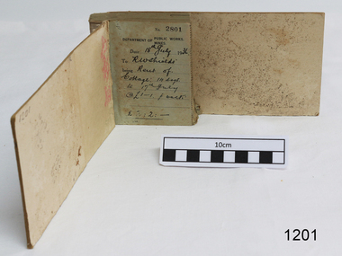
Financial record - Receipt Book, Department of Works and Mines Victoria, July 1936 (first record)
... of the state's geological structure, mineral wealth and underground water... structure, mineral wealth and underground water resources 4 ...Establishment and Functions Prior to 1860, the Chief Secretary's Department had been responsible for the administration of the gold fields and associated mining activities. In November 1860 a Commissioner of Mines was appointed and a Department was established under his administration. For the period November 1861 to June 1863, the Postmaster General was responsible for the Mining Department. A Minister of Mines was again appointed in 1863. Responsibilities of the Department of Mines were: 1. Regulation of mining and related public works activities through the issue of miners rights, business and residence licences, mining leases, mineral and other prospecting licences 2. Superintendence of the activities of mining surveyors, registrars, wardens and Mining Boards. 3. Investigation of the state's geological structure, mineral wealth and underground water resources 4. Development of the mining industry 5. Supervision of the safe working of mines, machinery and quarries including checking the credential of mine managers, inspectors and operators 6. Regulation of the disposal of sludge and other waste products 7. Administration of the Victorian Mining Accident Relief Fund. Arising from its initial responsibility for the supply of water on the gold fields, the Department became responsible for rural water supply from the mid 1860s. Statutory responsibility for rural water works during this period rested with the Board of Land and Works. In 1865 the Waterworks Act gave the Board power to construct waterworks, purchase land, levy charges and lease or sell works, while the Public Loans Act 1865 empowered it to provide loans to local water trusts for waterworks. The actual administration of these statutory provisions was undertaken by the Victorian Water Supply Department which operated from 1865 to 1889 as a sub-department of the Department of Mines, from 1889 as a department in its own right, and from 1895 to 1909 as a sub-department of the Department of Mines and Water Supply. For a brief period from 1891 to 1893 the Department of Mines was also responsible for forests and, until 1880, for the Schools of Mines subsequently transferred to the Education Department. In 1895 the Department of Mines and the Victorian Water Supply Department were amalgamated to form the Department of Mines and Water Supply. A snapshot into social history around the 1930s when the Department of works and the Mines Departments were still linkedReceipt Book for the Department of Works; Mines. Receipt No 2801 - 3000. 1st receipt Number 2801, "18th July 1936, for Rent of Cottage: 14 days for 2 pounds, 2 shillings. The inscription on the back is signed by J F Condau in 13-3-33Printed on spine "GENERAL RECEIPTS / 15 / 2801 / TO 3000" Printed on each receipt 'DEPARTMENT OF / PUBLIC WORKS. / MINES." Fill in using ink pen "(DATE) 18th July 1936 / (TO) - - - shields' / BEING) Rent of / Cottage: 14 days / (TO) 17th July / @ (symbol for pound) 1-1. p. week / . (symbol for pound) 2:2:-"Inside cover there is some red pencil writing, words and figures unreadable. Handwritten on back cover "Numbers checked / and found corredt / J S Coudou (?) / 13-3-33" One some receipts "Wharfage / S.S. Koonara"flagstaff hill, warrnambool, shipwrecked coast, flagstaff hill maritime museum, maritime museum, shipwreck coast, flagstaff hill maritime village, great ocean road, department of works: mines, receipt book, rent 1936, imperial currency, living costs 1936, department of works, department of mines, j f condou, 1933, 13-3-33